• MTB trails
    of VALLESTURA di Demonte
  • Accommodation/Eat out
  • Contacts
  • MTB Valle Stura NEWS
  • Services
  • Who we are
MTB ValleStura
  • Home
  • Mtb Trails
    • Aisone
    • Argentera
    • Demonte
    • PietraPorzio
    • Saben
    • Sambuco
    • Vinadio
    • Vignolo
  • Services
  • Accommodation/Eat out
  • Who we are
  • Contacts
  • English
  • Italiano

M11 – Lago Di Vinadio

10 June 202018 June 2020, Aisone Aisone Mtb Trails
  • Prev
  • Next

M11 Lago Di Vinadio

  • Departure/arrival location: Aisone / Aisone
  • Difficulty: Climb: TC, Descent: TC, Exposure: E1
  • Length: 17.8 km
  • Drop: +198 m
  • Departure altitude: 810 m asl.
  • Maximum altitude: 860 m asl.
  • Terrain type: 70 % asphalt, 30 % gravel
  • Type of route: ring-type, passing through: Goletta, lago Vinadio, Goletta, Centro Fondo Aisone, Forani, Perolar, Paluch, Perdioni, Lavoire, S. Giuseppe.

Description

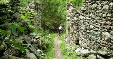
Starting from Centro Fondo Aisone, follow the road towards the town and then, before the Stura River, take the gravel road that goes up the valley to the village of Goletta where we enter the S.P. 337. After passing the iron bridge, we continue on the gravel road that runs alongside the river until we reach the lake at the foot of Forte Albertino. Retracing the last stretch backwards, follow the S.P. 337 to Perolar where we turn sharply right to head first to the Paluch and then to the Perdioni. Crossing the SP 337 we follow the gravel road that leads to a hydroelectric power station near Stura river where we take the road that crosses it reaching Lavoire area. From here we follow the gravel road that goes up the valley along the river to San Giuseppe where we pass on asphalt until we reach the bridge that allows to return to Centro Fondo Aisone. Along the route we can find red marks that reflect the symbols of the signpost, i.e. the triangle with two circles, which can help you find your way.

Download Trail: M11 Lago di Vinadio (External Link)

Gallery

Posted in Aisone, Aisone, Mtb Trails
MTBAdmin
  • Facebook
  • Twitter
  • Google Plus
  • Pinterest

Post navigation

M7 – Colle Angelino   

You may also like

A1 – FORTE DI NEGHINO

Continue Reading

A2 – COLLE DI NERAISSA

Continue Reading

PLEASE NOTE

No liability is accepted for damages and\or accidents to people and\or things on the trails indicated on this site.

PRATICABLE TRAILS

Check which trail is accessible at the moment!

No post found

Follow us

1 Vallata La magnifica Valle Stura
10 Comuni in provincia di Cuneo
41 Percorsi MTB Provali tutti!!
Tante strutture ricettive Bike friendly

© ASD ValleSturaSport - Demonte (CN) | Web by GigiWork
Questo sito utilizza i cookies, navigando accetti l'utilizzo dei cookies da parte nostra OK Ulteriori info
Privacy & Cookies Policy

Privacy Overview

This website uses cookies to improve your experience while you navigate through the website. Out of these, the cookies that are categorized as necessary are stored on your browser as they are essential for the working of basic functionalities of the website. We also use third-party cookies that help us analyze and understand how you use this website. These cookies will be stored in your browser only with your consent. You also have the option to opt-out of these cookies. But opting out of some of these cookies may affect your browsing experience.
Necessary
Always Enabled
Necessary cookies are absolutely essential for the website to function properly. This category only includes cookies that ensures basic functionalities and security features of the website. These cookies do not store any personal information.
Non-necessary
Any cookies that may not be particularly necessary for the website to function and is used specifically to collect user personal data via analytics, ads, other embedded contents are termed as non-necessary cookies. It is mandatory to procure user consent prior to running these cookies on your website.
SAVE & ACCEPT