A 27 La Meja
- Departure/arrival location: Colle di Valcavera
- Difficulty: Climb: BC Descent: BC Exposure: E2
- Length: 26 km
- Drop + : 600 m asl
- Departure altitude: 2417 mt
- Maximum altitude: 2534 m
- Terrain type: 80% military road 20% trail/mule track
- Route type: High mountain ring route with modest drop and not too demanding terrain, with postcard view on Rocca la Meja peak. Gardetta Refuge is an excellent foothold at half way. The area is also of great historical interest as we cycle on an impressive military road and we meet some barracks. Access by car is from Vallone dell’Arma (Demonte) arriving at Colle di Valcavera (start point of the route) overlooking the so-called Gardetta plateau with a priceless view. Note that part of the ring is part of “Gardetta Bike Emotions”: a touristic product of Cuneo Bike Experience by Conitours. https://www.piemontebike.eu/it/percorsi-ciclabili/gardetta-bike-emotions/e10e2dea41a42298b73b20c02d21f332/
- Cartography: Fraternali Map 1:25000 MTB\E-Bike Valle Stura di Demonte
Description
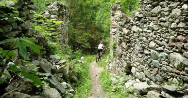
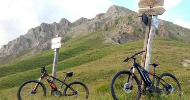
From Colle di Valcavera (2417 meters above sea level), after a very short stretch of asphalt, we take the military road which, after a short ascent, takes us in the direction of Colle della Bandia. Near the old brick fence of the ammunition depot of the barracks of Bandia we leave the main road to take the mule track to the right which climbs steeply and on a rough ground to Colle d’Ancoccia (2534 meters above sea level).With a short sliding descent we reach Meja lake, the view of the mountain with the same name is breathtaking. We continue descending on a compact ground up to Colle Margherina (2407 meters above sea level). Without crossing the aforementioned hill, we take a path in north-west direction which, on a slightly uneven and irregular terrain, loses altitude reaching Gias della Margherina area (2169): During the descent, on the right, the imposing walls and peaks of Rocca la Meja (2833 meters above sea level).From here, on a sliding gravel road along the hillside, we can reach Colle del Preit (2075 meters above sea level) where we can have a rest at Agriturismo La Meja, or just to stock up water at the fountain. We start going uphill on a gravel track with a slightly rough surface up to Rifugio della Gardetta (2337 meters above sea level) located in a privileged position inside old barracks, ideal for a rest. We go back a little and, at the crossroads, turn right on the military road called “Altopiano della Gardetta”. It is a majestic military work, more than ten kilometers long, it starts from Gardetta Pass up to Colle di Valcavera allowing an easy cycling on a slightly uneven terrain enjoying the panorama, as far as the eye can see. First uphill, and then in ups and downs, we pass near hills Salsas Blancias, Margherina, Bandia (2408 meters above sea level here there are barracks that date back before the great world wars), we are still in Sambuco municipality. We return back to Colle di Valcavera (2417 meters above sea level).
All the paths are frequented by hikers on foot, pay attention especially on descents: THE PEDESTRIAN ALWAYS HAS THE RIGHT OF WAY.