A26 Altopiano della Gardetta
Departure/arrival location: Sambuco
Difficulty: Climb: BC+ Descent: OC+ Exposure: E3
Length: 43 km
Drop + : 1700 m
Departure altitude: 1185 m asl
Maximum altitude: 2606 m asl
Terrain type: 55% Gravel/Military 40% Trail 5% Asphalt
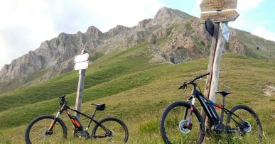
Type of route: High mountain ring route. Partly using “Lou Viage” trail. It reaches some very scenic spots such as “Pilone” , Colle Salsas Blancias and the whole road that crosses the Gardetta plateau and passes through the homonymous Refuge, ideal for a restful break. The track, especially in the last part, is reserved for very experienced bikers given the highly uneven bed in both climb and descent with some exposed sections.
Cartography: Fraternali Map 1:25000 MTB\E-Bike Valle Stura di Demonte
Description
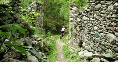
From Piazza del Municipio in Sambuco, we cycle uphill taking the steep Via Moriglione street. Leaving the village behind us, we go up a steep gravel road with a fairly rough terrain to Serre Bianco hamlet and, after a short descent on a easy path, we go up on a mule track and compact gravel road to the sunny hamlet of Moriglione S.Lorenzo (1435 meters above sea level).From here we continue uphill on a cart track with moderate slopes and a fairly compact terrain up to the area called “Pilone” (1913 masl,) from which we have a nice glance on Monte Bersaio and the Stura Valley with the Maritime Alps in the background .We now continue the climb with much more sustained slopes and at times very uneven ground, we pass through Gias Vallonetto area (2083 meters above sea level fundamental water supply), Colle Guia and then we arrive, with some challenging hairpin bends, to Colle di Salsas Blancias (2454 meters above sea level). Descending, the view of Rocca la Meja peak is grandiose. We descent a little arriving on the famous military road Gardetta which crosses the plateau of the same name in about 14 km and is of great interest from a nature and history point of view. We move westwards in ups and downs on a irregular terrain up to the Gardetta Refuge ideal for a restful stop (2337 meters above sea level).We climb the military road to the Gardetta Pass (2439 meters above sea level). From here the climb is on a small mule track, exposed and with a very bumpy terrain, in some cases at the limit of cyclability. Once on Passo Roccabrancia (2606 meters above sea level) we begin the long and physically demanding descent on a path with a very uneven and irregular terrain, we pass through the Gias dell’Oserot area and the ruined hamlet of Servagno (1737 meters above sea level) after which a series iof very closed hairpins is performed. Continuing on the GTA tral (Great Crossing of the Alps) we arrive at the village of Pontebernardo (1280 meters above sea level; be careful crossing the Stura River with abundant water).Taking the easy forest track we reach the town of Pietraporzio and then return to Sambuco.
All the paths are frequented by hikers on foot, pay attention especially on descents: THE PEDESTRIAN ALWAYS HAS THE RIGHT OF WAY.